![]()
![]()
|
|
|
Earlier versions imported coordinates without transforming them. In the case of Gauss-Krüger coordinates, distortion was insignificant in practice. However, distortion increases when you work with the UTM coordinate system.
During ![]() Import of AutoCAD data, you can define how to transform data in the UTM coordinate system into data of a Gauss-Krüger coordinate system. To do this, use the Coordinate transformation area in the
Import of AutoCAD data, you can define how to transform data in the UTM coordinate system into data of a Gauss-Krüger coordinate system. To do this, use the Coordinate transformation area in the ![]() Settings.
Settings.
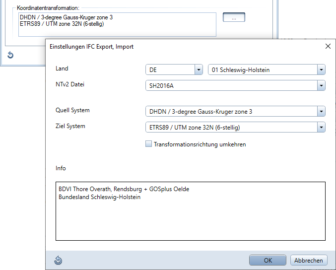
Note: Due to the notation and different widths of the latitude bands, the coordinates of the data are different. When you work with Gauss-Krüger coordinates, the zone comes first (that is, Gauss-Krüger zone 3 instead of 3,000 km).
|
(C) ALLPLAN GmbH |
Privacy policy |