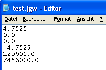
JGW and TFW files, which contain geographic information on bitmaps, are ASCII text files describing the location, scale and orientation of an image. These world files are six-line files with decimal numbers separated by dots on each line.
You can open and modify JGW and TFW files using an editor. You can also create your own files.
The values mean the following:

| (C) Allplan GmbH | Privacy policy |